What is trail grading?
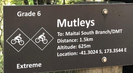
Almost every (official) mountain bike trail will have a sign at the start of it. They'll be colour-coded, or numerically-coded, or picture-coded, or some combination of all of these. The sign relates to the trail's grade (or rating) and it's the community's way of telling you what to expect.
The idea of grading didn't start in MTB. We borrowed systems from ski fields, where green, blue and black runs are (largely) easily understood and (broadly) accepted.
In New Zealand we use six grades, from Grade 1 (easiest) to Grade 6 (extreme). The system grew out of one developed by the Kennett Brothers, and it's used by DOC, the Great Rides and most of our trail networks. Recreation Aotearoa recently funded the development of new trail guidelines for New Zealand which were released in 2025, and are in the process of being adopted nationwide.
On the sign, a grade is a single label. In practice it's read by several different people, and each of them is asking it a different question.
The rider
For a rider the question is 'is this trail for me?' The grade is a quick check against your own skill and confidence level. But this check depends on your prior experience. If your experience of 'blue' comes from machine-built flow trails, it likely differs to a rider used to janky natural 'blue' singletrack.
The builder
The trail builder might read the grade as 'what I am meant to build'. Hence, the grade works more as a specification. Design guidelines set out targets for each grade, such as average gradient, width, or corner radius, and expect a new trail to stay broadly consistent with its grade.
Managers and operators
For people promoting trail networks, grades are critical to advertising the trail offerings to potential visitors, yet they also clearly link to the understanding of risk that riders might choose to expose themselves to.
One label, many readings
Most of the time those readings broadly line up, and nobody really notices. The interesting part is when they don't: when a trail is built to one grade, signed as another, and ridden by someone who was calibrated on a third. Region and terrain also play a big part. Trails often end up calibrated locally (i.e. the 'black' trail is the hardest of the offerings at a given location, rather than a standard 'black' level).
Ultimately, our historic systems include a lot of subjectivity.
International Standardisation?
The International Trail Rating System (ITRS) aims to take a more specific, measurable (dare I say, more engineering) approach to trail rating. The system also adds endurance, exposure and wilderness ratings, so readers have more to go on than a single colour or number. Whether that works in practice is a question I'm hoping to explore.
Over the next few months I'll be running a field study at Hanmer Springs, where ITRS ratings are being trialled on selected trails, to see how the system is received by the people who ride, build and manage them.
I'll be writing more about the study, including the rated trails and how you can get involved, as the work progresses.